Mapping Manning
The Man who Collected Oxfordshire
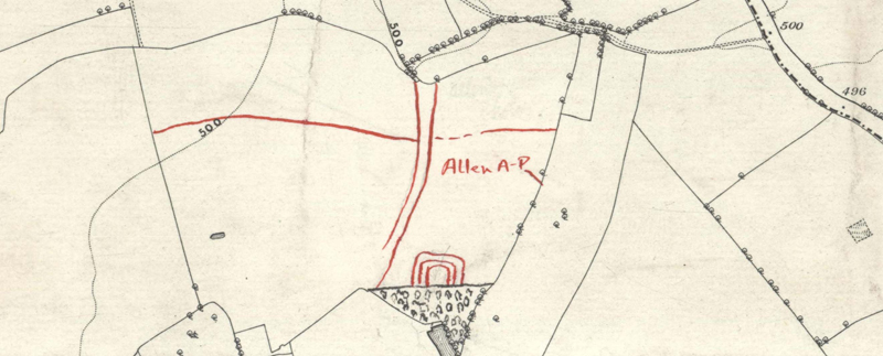
Oxon, CHARLBURY
[features shown include a possible droveway and a rectangular enclosure with 3 concentric ditches(?)] [annotated in ri:]"Allen A-P" [Also, triangular woodland block added in bi to south, obscuring part of enclosure cropmapk]
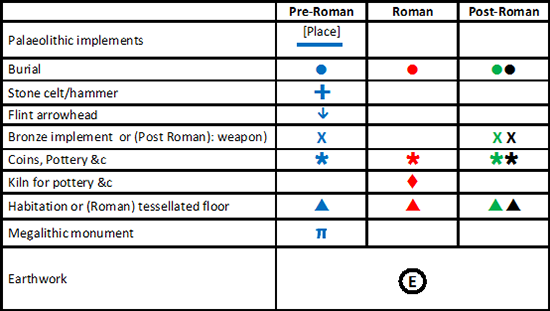
Reveal Map Key