Mapping Manning
The Man who Collected Oxfordshire
Oxon, LEAFIELD
[a cropmark sketch, consisting of a slightly excentric ring surrounded by a much wider dashed ring, the latter apparently with an 'opening' to the NNW, with circular 'terminals' on each side; form (and possibly other overlapping ringforms) visible on 1/1/1945 AP on GE]
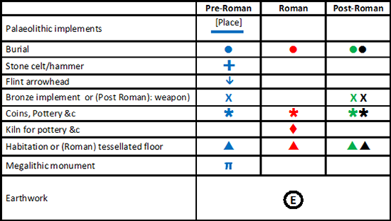
Reveal Map Key