Mapping Manning
The Man who Collected Oxfordshire
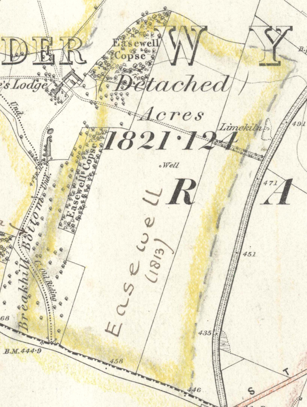
Oxon, RAMSDEN
[shown with a dashed p outer line boundary where no boundary feature on Map044]
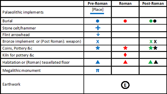
Reveal Map Key
Oxon, RAMSDEN
"Easewell (1813)"[fieldname, broadly corresponding to the area demarcated om MMR016; cf. P0416]
Reveal Map Key