Mapping Manning
The Man who Collected Oxfordshire
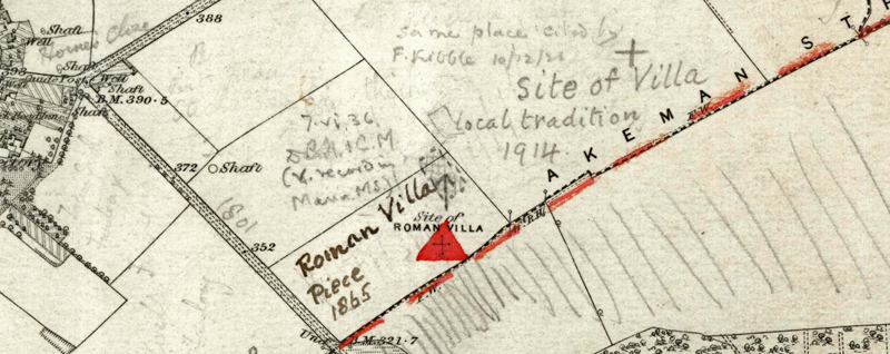
Oxon, STONESFIELD
[hachured rectangular form with dashed outline marked (just crossing modern field bundary to north), with arrow from south (indicating that original location in MMR0618 is incorrect), and annotation:]"7.vi.36 D.B.H. & C.M. (v. record in Mann. MS.)" [Also, another rectangle sketched in field immediately to NE]
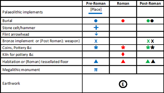
Reveal Map Key