Mapping Manning
The Man who Collected Oxfordshire
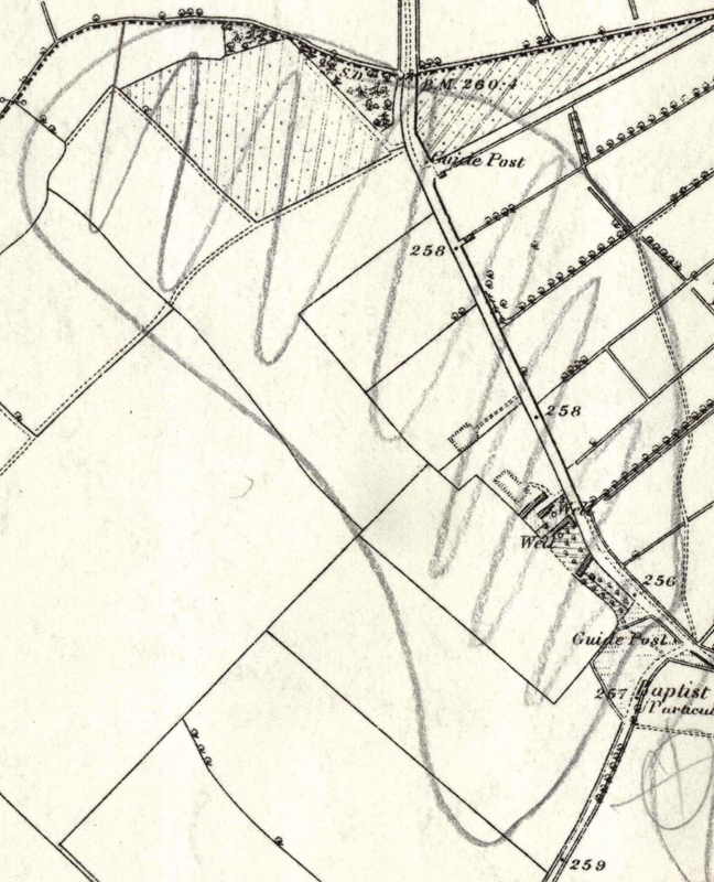
Oxon, DUCKLINGTON
[NB: This and other hachured areas in the vicinity, may be showing gravel outcrops (with their significance for cropmark formation); cf. MMR1366 for an explicit analogy]
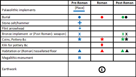
Reveal Map Key