Mapping Manning
The Man who Collected Oxfordshire
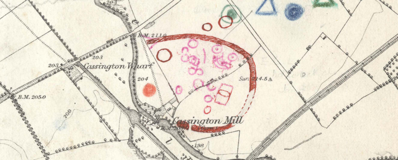
Oxon, CASSINGTON
[cropmark complex, with many ringforms and a few small linear enclosure, mostly inside an apparent very large (>200 m diameter) ringform? open to the west; apparently two generations of marking, 'pink' overwritten by true ri; undeciphered p annotations to east] [COMMENT: these very large 'ringforms' (cf. MMR0976 & MMR0992 ) seem improbable and are more likely to be natural fossil floodplain structures]
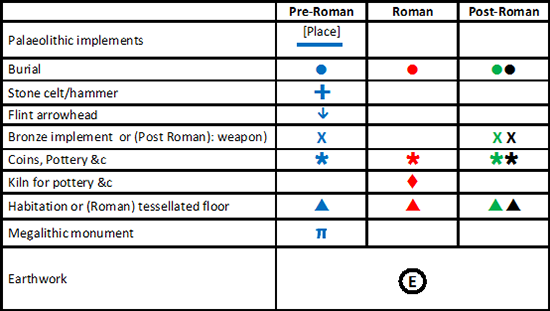
Reveal Map Key