Mapping Manning
The Man who Collected Oxfordshire
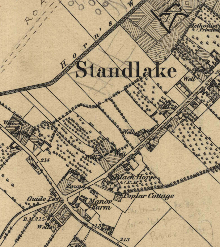
Oxon, STANDLAKE
"The Limes 1830 (or in 40 years later [?] Poplar C[???])"[possible fieldname or road name?] [NB: long location line, from annotation northwards right across the village]
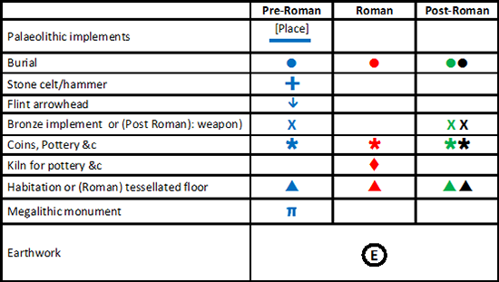
Reveal Map Key