Mapping Manning
The Man who Collected Oxfordshire
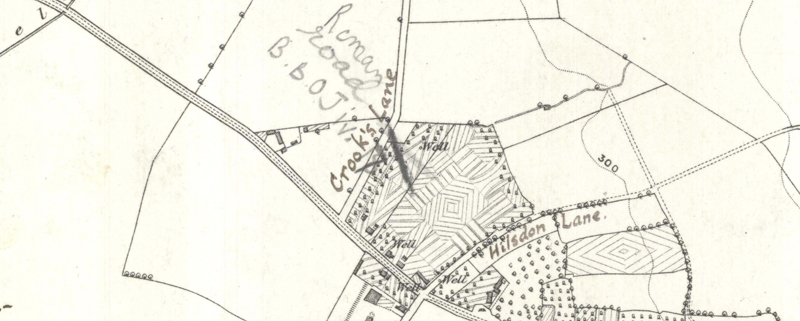
Oxon, GARSINGTON
[short stretch of road shown, annotated in p:]"Roman road B.B.O.J. iv 17 Pottery (R.B)"[Berks Bucks & Oxon Archaeological Journal 1898-9, Manning article] [also shown in bi are the two "green lanes" Manning mentioned then flanking the location:]"Crook's Lane"[and]"Hilsdon Lane"
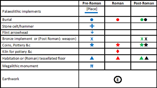
Reveal Map Key