Mapping Manning
The Man who Collected Oxfordshire
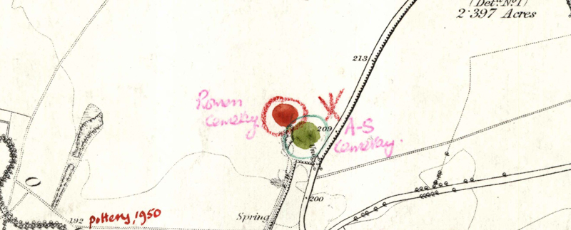
Oxon, FRILFORD
[original w circle later annotated in red f:]"Roman Cemetery."[then ringed in red c] [NB: quarry]
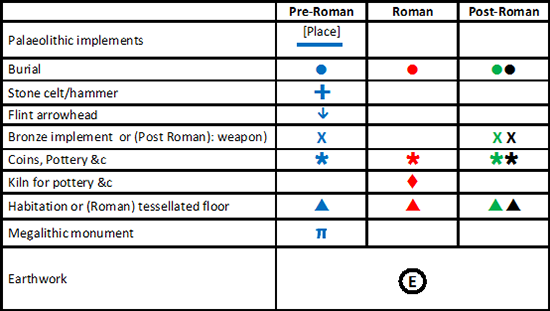
Reveal Map Key
Oxon, FRILFORD
[NB: quarry; cf. P1861: this red c is the same that was used to circle MMR1861 and the star may (finally) have been thought to be the most certain way to record this site]
Reveal Map Key