Mapping Manning
The Man who Collected Oxfordshire
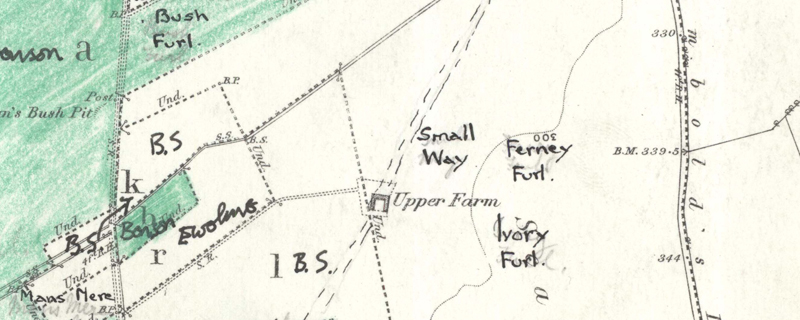
Oxon, EWELME
[originally shown as continuous p lines, indicating a local trackway within old Berrick Salome Parish; subsequently changed to dashed lines in bi; possibly related to the fieldname "Small Way" (MMR2320); P2325 sample only]
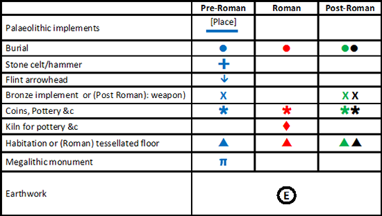
Reveal Map Key