Mapping Manning
The Man who Collected Oxfordshire
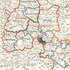
Oxon, CHECKENDON
[fortification earthwork perimeter also marked in bi, within woodland labelled on Map110 OS:"Castle Grove"]
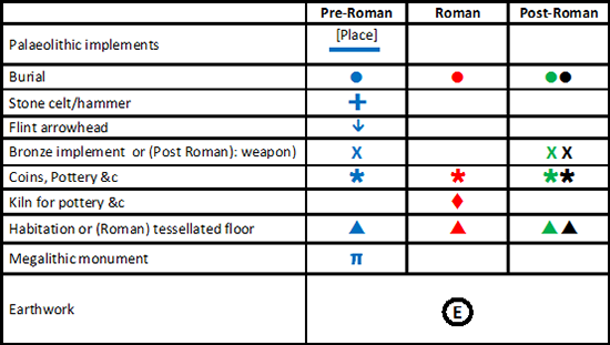
Reveal Map Key
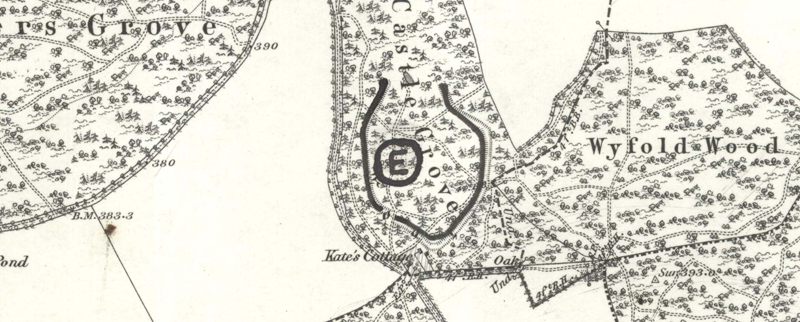

[fortification earthwork perimeter also marked in bi, within woodland labelled on Map110 OS:"Castle Grove"]